Le Grès d'Annot - walk - hike
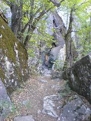
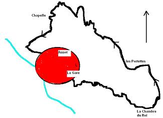
This walk was done by us in the summer and was magnificent, Annot nestles at the foot of a sandstone hill and the walk is a must if you are in the area. It is a circular route starting in the Place de Revely, walk down the high street towards the RN 202 past a large hotel on the left and follow the signs to the train station at the end of av de la Gare. At the station follow the signs for the "Chambre du Roi" with the yellow markers, the path is very straight forward and you climb through trees past sandstone out crops a few being established climbing points. The "Chambres du Roi" is a sandstone room an enclave in the rocks and is quite spectacular.


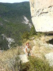
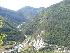
From the "Chambre du Roi" the path leads you to the edge of the hill side and the views are of the valley below & the Gorges de la Galagne. For the faint hearted you can now reverse your steps and go to Les Portettes or follow the path on the cliff side and be rewarded by further spectacular views. The walk along the cliff face only lasts a couple of minutes then you turn back into the hill itself up into a wooded glade, you could be on the valley floor not at a 1000m, it is so peaceful. There are other walks crossing the hillside the one you want to keep to is towards Les Portettes go through them and follow the path NW this takes along the valley with Annot below. Then we start the descent through the trees to the vers la ville chapel, which is said to be the original site of the village. From then on it is a flagged path down to the village, where you can easily loose yourself wandering through the streets  .
.
Flat distance 4802.10 m
Actual distance 4984.31 m
Minimum height 683 m
Maximum height 1023 m
Total height ascended 474 m
Trail : Waypoints
Gare East: 32:313292.81 North: 32:4870512.72 Height: 713 m
Chambre Roi East: 32:314105.69 North: 32:4869988.61 Height: 913 m
Les Portettes East: 32:314001.74 North: 32:4870395.13 Height: 1020 m
Chapelle East: 32:313194.60 North: 32:4871051.38 Height: 737 m
Co-ordinates system : UTM (Zones 30,31,32), WGS84
