Rocca Sparvirèa - walk - hike
This is a very easy walk with broad paths and you're rewarded with the remnants of a ruined village and fantastic views of the Vallon de Duranus and the valley of the river Contes. To get to the walk take the RN 202 from Nice up to Entreveaux and turn off on to the D2565 to St Martin Vésubie keep going until the road crosses the river to the southern bank and then just before St-Jean La Rivère the is a very sharp turn on the right towards Duranus. Just before getting into the village there is a lay by park there it is the start of the walk. If you go through a tunnel in the rock or enter the village you have gone too far. This is the issue with this walk there are not many places to park the car even in the village so good luck!.
The path starts as a concreted track but after the first couple of bends changes to a dirt road and continues to wind itself up through the trees until it levels off. This is where you meet sign post marker No 441 this is where the path meets the one that comes up directly from the village.
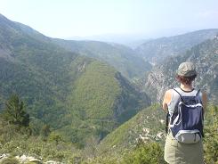

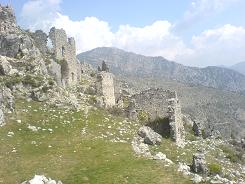
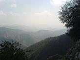
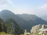
The path stays as a wide vehicle track and almost contours to the head of the valley, you pass marker 442 which indicates an alternate route along the crête edge and a Bergerie (Sheep station). As you reach the head of the valley the path puts in a couple of zig zags until you get to sign post marker No 443 where you take the narrower path leading off up on the left to Rocca Sparvirèa. The path was obviously part of the village's defences and puts in some twists & turns until eventually you see the chapel of St Michel on your right & the ruins of the village straight ahead of you.
Flat distance 10648.51 m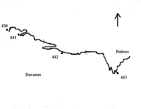
Total height ascended 1106 m
Actual distance 11026.77 m
Minimum height 490 m
Maximum height 970 m
Trail : Waypoints
450 East: 32:359872.19 North: 32:4862239.17 Height: 499 m
441 East: 32:360142.60 North: 32:4862143.57 Height: 563 m
442 East: 32:361096.89 North: 32:4861665.76 Height: 772 m
443 East: 32:362393.44 North: 32:4861079.68 Height: 957 m
442 East: 32:361096.89 North: 32:4861665.76 Height: 772 m
441 East: 32:360142.60 North: 32:4862143.57 Height: 563 m
450 East: 32:359872.19 North: 32:4862239.17 Height: 499 m
Co-ordinates system : UTM (Zones 30,31,32), WGS84
