Sallagriffon - Mont St Martin - walk - hike
This weekend we ventured up the Esteron Valley to walk to the summit of Mont St Martin from Sallagriffon. The fastest way from the coast is up the Var to Puget Théniers then south to Le Plan and onto Sallagriffon. We took different routes there and back the more scenic through Gilette on the way there the quicker returning. Driving up the A8 on the way to the 202 we were surprised to see snow on the mountains behind Nice as it was not yet mid September. I suppose it was just a reminder not to be complacent in the mountains but Mont St Martin has a height of 1257m below that day's snow line.
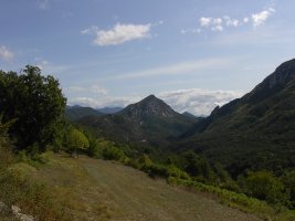
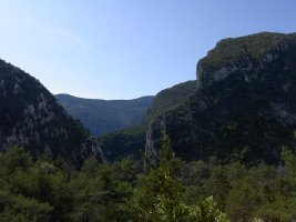
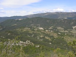
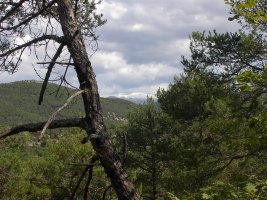 Sallagriffon is a quaint little village surrounded by agricultural land approximately 6km from Sigale . They have a car park before the village with a sign welcoming walkers to leave their cars there. The area is easily recognisable by the street lamps – they have the same in Thorenc and other villages in the proximity. They must have been a job lot – over production for a film set one would guess – the Lion Witch and the Wardrobe for example. The walk starts at SP 75 just on the right of the road leads into the village. It is a tarmacked road leading away from the village. This takes us past some houses then down into the valley below. As the village recedes behind you the path opens out into meadow and woodland. he walk is approx 12km with 1200m climb and a grade 3 because of the scramble at the summit, this can be left out.
There is a junction but take the path marked Aiglun (the signs are blue), there is a popular canyoning spot at the Clue d'Aiglun. The path for the Clue splits off at SP 75b you continue in a SW direction to Mont St Martin. The climb now steadily increases in earnest up to a ridge, there wheren't any yellow markers I could see up to this point but the path is well defined. The first yellow markers were at the ridge taking you into the Aire du Mont – the path levels out to SP 75c.
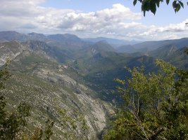
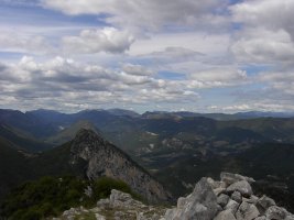

From there make your way to SP 76 – straight on Aiglun. At SP 76 you have a choice, you can take the route back to Sallagriffon or do a spur to Brèche du Mont St Martin. From the Brèche du Mont St Martin there is a scramble up the rocks to the summit of Mont St Martin. This walk includes the spur and the scramble. The path contours on the whole to the Brèche du Mont St Martin at SP76a. If you want to go to the summit, there is a small path through the bushes on the right. There are two rock walls to climb the first being the hardest, but the path is not that easy to follow despite the small cairns. Keep to the ridge and you will make the top, the path is easier to see on the way down.
Trace your steps back to SP 76 on the Aire du Mont. In fact on your way back to the Aire the return path to Sallagriffon can easily be seen on the opposite mountain side. The views from here down the Esteron Valley a superb with Sigale as a focal point. At SP 76 take a right which takes you on a gentle descent down the side of the mountain.
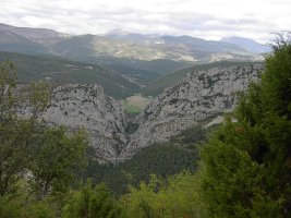
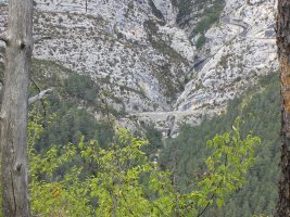
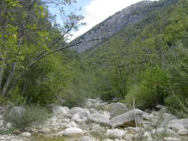
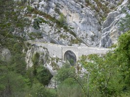
When it reaches the far end there is a hair pin and you have views of the Clue du Riolan, and the bridge that carries the GR510. The path sweeps round and then starts a steep descent through the trees to the valley floor. The valley floor is wide at the river crossing and can be crossed by stepping stones (take care if in flood) the Guide Randoxygène mentions a deviation which we did not take. The climb back up the other side to the GR510 is quiet steep but short lived.
Take a left at SP 77 and proceed to the bridge, you are now on the GR510. The bridge was the border between Savoy and France in and bridges the Clue. From there on in it is a yomp back to Sallagriffon along the GR510. At the village come off the GR510 and walk through the village to get back to the car park.
Actual distance 11950.00 m 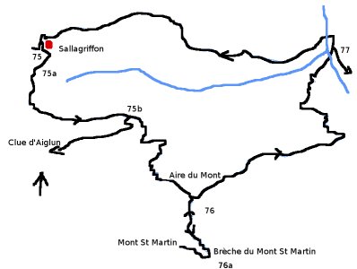
Min height 559 m
Max height 1225 m
Height climbed 1121 m
SP75b East: 32:332444.02 North: 32:4860279.48 Height: 784 m
SP76 East: 32:332932.23 North: 32:4859527.34 Height: 1073 m
Summit East: 32:332830.34 North: 32:4859097.78 Height: 1225 m
SP76a East: 32:333008.84 North: 32:4858979.21 Height: 1154 m
SP77 East: 32:334304.47 North: 32:4860783.30 Height: 599 m
Pont East: 32:334239.39 North: 32:4860849.98 Height: 581 m
