Château de Sainte-Agnès - walk
This walk is not far from Menton and the coast. The areas along the coast are almost always built up and can mean blocked walks which deters from the whole experience. In fact in constructing this site we have completed some walks that we have not documented as they have been so disappointing. This one after a disappointing start turned out well and so appears on these pages. The walk starts in the hamlet of Colline which is a spread of houses along the D22 from Menton. The easiest way to get there is via the A8 motorway, take the exit for Menton. If coming from Nice as you descend from the exit the road to get back on the motorway going back the way you came is in front of you. There is a sign pointing up this slip road back to Nice indicating St Agnès, follow it.
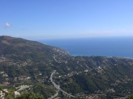
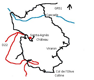
The road veers off the slip road to the right, just before the give way back to the motorway. Keep on this road for the next couple of kms. It is disorientating as it threads back under the motorway a number of times. Parking is not easy. We found some along the route col des Olives. It is a local path here with the yellow splashes of paint to show the way. In this area the paint splashes are far & few between but the path follows the road east along the col des Olives. Where the road comes to a crossroad, it widens. There are some community bins and the path veers off to the left. We did not see any markers. The path meets a concreted road take a right and you are contouring. The view of the valley below opens out and the noise from the road dissipates. There is a path directly up to the village but we are going the cascades first then the GR51. The road becomes gated but there is a thoroughfare on the right. Keep on the concrete road, this is Viraron.
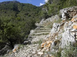
There are properties either side follow the road to the right. In front of you is a big yellow house – although there is no indication the path goes down the side of the house. The path contours and then climbs back up in amongst some houses, you know you are in the right place as there are signs every where stating “Private Property” or “No Entry”. Keep to the road and eventually you pass a green steel barrier. The road becomes a track, and it becomes evident the area is a dumping zone for fly tippers. There is graffiti and rubbish every where although some of the turmoil has been caused by nature. There is evidence of a concrete bridge that crossed the river – which has now been washed away. There are a number of water pipes running up to the top of the falls – which seem to have dried up the flow of the water. This becomes clear later on in the walk as the river is healthy up stream. Cross the river keeping the cascade to the left and the path starts to climb steeply up the valley side. There is evidence of an ancient path as you weave through the trees. As the path starts to level you meet the GR51 outside the La Virette ruins. From here take a left and follow the red and white markers.
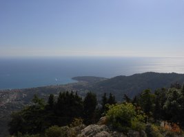
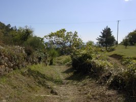
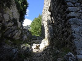
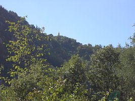
The walk is now in a very attractive area and the path very wide and ancient. There is the first view of the village of Sainte-Agnès. Keep to the path and you cross the river to the other side of the valley. The path continues to the col before the village, from here we take a detour into the village and up to the Château. The Château is being restored and visitors are asked to make a contribution to its continuation. The views are amazing and there are some interesting tit bits of information and gardens to be seen. The descent takes you back to the col before the village and just off the first road descending down the valley the path continues taking you behind the school. The path is easy to follow on the way back, crossing the road twice. The first time turn left follow the road for a couple of hundred meters then turn down right. The second time, turn right along the road for a short distance - then take the path on the left.
Now for a bit of a rant.
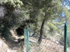
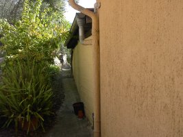
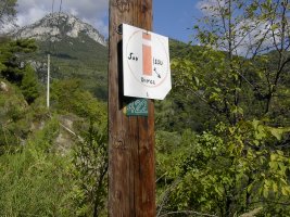
The area here is beautiful and has been inhabited by man for 1000s of years. There is probably little or no land that has not been affected by man or man's husbandry over the centuries. The area here is criss crossed by a network of paths connecting villages and towns and are established rights of way. What I find disconcerting is when these routes are blocked or obscured by property owners with their new concrete palaces destroying the tranquility - peace one presumes they were looking for. This last walk had some niggling examples:
The first picture is a path - but it looks like path to someone's back garden! The other shows the effort people will go to to obscure walking markers. Yes that is a yellow marker under the No 422. If people have to build in these areas they should recognise that the paths were there first. Also walkers do not want to hang around people's houses looking for the path.
So what came first the path & marker or the fence. When it comes to the countryside I do hold strong views, some extreme. I believe people who litter should be made to eat what they drop, Fortunately the government do not support these views and I am no vigilante. Rant over.
Actual distance 8002.60 m
Total height ascended 769 m
Minimum height 235 m
Maximum height 750 m
Grade 1
Trail: Waypoints
cass East: 32:376760.53 North: 32:4851393.32 Height: 306 m
chat East: 32:376402.56 North: 32:4850879.86 Height: 750 m
collin East: 32:376084.56 North: 32:4850384.52 Height: 492 m
Co-ordinates system: UTM (Zones 30,31,32), WGS84

