Roquesteron - Cuébris - walk - hike
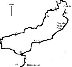
This walk is not in the Rando Moyen Pays and is partly on the GR510 and the rest on a local walk. GRs have the red & white markers the local walk has a yellow strip, the quality of the path actually follows this the GR is well trod the local path was not so easy to follow. The walk is a circular walk based at Roquesteron, we tackled it in an anti-clockwise direction and the going was easy on the way to Cuébris, the way down through the oak groves was not so easy to follow & quite steep in places but I would still grade this as a medium difficulty. The path starts in the main car park on the D17 with the un mistakable and tasteful municipal neon sign that would look better off in a Ski resort. The car park is on the left as you go through the village coming from Gillette. The first sign is on the right if facing into the rear of the car parking area and the path we are taking is the ciruit des abeilles.
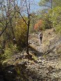
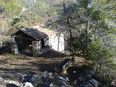
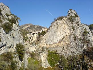
The path is well marked on the way up making use of the road in 2 places and 2 sets of concrete steps and takes you up to a pretty chapel called the Chapelle de Notre Dame which is where you get your first views of the village. Cuébris itself is a very quiet village nestled in a pass and has expanded now into the hinterland and boasting 3 Gites but no Cafe or bakery in evidence. To follow the path you take the main road through the village to marker 85 which will send you up the hill in a westerly direction the path now takes on the yellow markers of a local path. The path takes on an almost straight route up the side of the hill and veers south at the close to the summit at waypoint 87
where the sign is incorrectly set, you need to take the path the sign says to Cuebris although it is in the direction on Roquesteron the path we want goes in a south westerly direction.
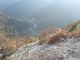
we had lunch at this point as we had finished climbing.Only to discover after lunch a perfect spot for lunch after passing through some trees along the path. From then on you pass through an oak wood and you have to pay attention to find the yellow markers of which there are plenty. After the wood you meet an easy scree field which has a view of Roquesteron directly below.
The path then takes you into another oak wood and you start the descent in earnest back to the village and car park. This can be quite steep in places and when we did it in November a little over grown so more care had to be taken keeping to the markers.
Flat distance 5923.59 m
Actual distance 6106.05 m
Minimum height 344 m
Maximum height 739 m
Total height ascended 614 m
Total height descended 614 m
