Cézaire sur Siagne - walk - hike
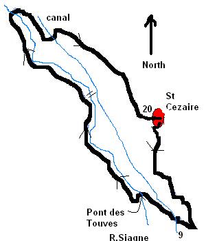
This is a very pretty walk, can be done all year around and rated as easy as it does not have any steep inclines and is only 7 km. The walk is a circular walk starting in St Cézaire going down to the Siagne valley walking along the river and then back up to the village. If you have children with you it is ideal with lots of distractions to keep them amused it ends back in the village and if you time it right the restaurants are open for refreshments afterwards.


The walk starts in a gap between the houses on Rue d'Egalité if you walk from the square past the church on the left the gap is around 100 yards up on the right. The path descends into the valley and is wide and maintained, you pass the village wash house and then you understand why the path is so well established  .
.
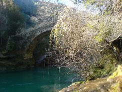
At the fork take the route towards Pont de Tuves you will come across the canal and then the path will begin to narrow as it descends towards the river. As you approach the river you need to go under a waterfall before crossing the old roman bridge.
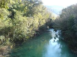
After crossing the bridge you come to a ruined building and you follow the path on the right following the river. The path follows the river and there are some small beaches which are ideal for a paddle or a spot of lunch. There is a steel girder bridge in a wooded part of the walk & you need to come off the path to get to it. After that the path does climb a little away from the river but not far out of view until you pass some cottages and will descend to the river to a stone bridge that will take you back across the river. The path from then on in is wide and makes the ascent back up to St Cézaire, there evidence of the traffic that used to take this route in the key stones lining the path which were used by carters to help them manoeuvre the carts.

Flat distance 6710.94 m
Total height ascended 525 m
Actual distance 6847.50 m
Minimum height 162 m
Maximum height 480 m
start East: 32:321952.01 North: 32:4835296.75 Height : 466 m
canal crossing East: 32:322140.04 North: 32:4834372.96 Height : 233 m
Roman Bridge East: 32:321806.56 North: 32:4834665.93 Height : 173 m
Bridge East: 32:320729.99 North: 32:4836538.87 Height : 204 m
canal crossing: East: 32:320956.51 North: 32:4836234.93 Height : 234 m
