Coursegoules - Valley walk
We tried this as an alternative to the usual ridge walk - the Circuit de Viériou. The path shares the same route as the end of the Circuit de Viériou, goes along the valley around a hill called Le Pret (which you can see due west from the village of Coursegoules). To get to the start you need to drive up to the village from the D2 and Vence turning off on the D8 and approaching the village from the south. There are 3 turnings into the village from that road - take the 3rd one, heading for the centre of the village, almost doubling back on yourself. As you enter the village there is a bar on your left with tables on the other side of the road with a good view of the valley. There's parking along that stretch up to the town square and there are more parking spaces if you continue through the square and take a sharp right up a small rise to behind the square. The walk starts from this car park behind the square. Facing the mountain behind the village go to the far right corner of the car park and take the steps down to the road below, turn left to go out of the village and the path descends rapidly on the right hand side. This takes you to a ford in some trees at the bottom of the valley, cross it and take the path which veers left taking you up along the valley side. The path is well trodden and easy to follow. It will take you past the Chapel of St Michel and up to sign post marker No 13a. This is where the ridge walk & the Valley walk go their separate ways. The ridge walk takes a left up the hill side, while the valley walk goes straight on. It's an attractive walk taking you through oak groves and meadows until you descend to sign post marker 180. From here on the path becomes a little more difficult to follow.


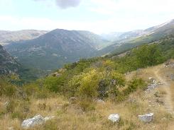
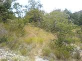
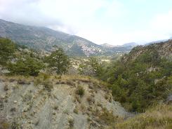
This is mainly because the soil becomes shale and the path errodes quickly. It's still marked but you need to pay a bit more attention. Initially you are in an oak scrub but then it opens out into meadow and you definately get the feeling that not many people take this route. The last picture shows a view of the village taken from these meadows just before you descend onto the valley floor below. From the meadow keep right and follow the path down the right hand side of the ravine, it is a bit of a scramble in places, despite the geology being treacherous it is also quite pretty because of the folding in the rock and the staining from copper & iron. On the valley floor it is straight on for the road the D8 and the yomp back into the village.
Flat distance 10135.67 m
Total height ascended 578 m
Actual distance 10244.21 m
Minimum height 914 m
Maximum height 1210 m
Trail : Waypoints
CP East: 32:342448.03 North: 32:4851001.64 Heigh: 1032 m
13a East: 32:341327.58 North: 32:4851871.02 Heigh: 1168 m
180 East: 32:338489.71 North: 32:4851467.16 Height: 939 m
17 East: 32:341756.33 North: 32:4850815.93 Height: 969 m
16 East: 32:342026.24 North: 32:4850833.11 Height: 956 m
Co-ordinates system : UTM (Zones 30,31,32), WGS84
Get directions to Coursegoules with Google Maps below
