Escragnolles (La Colette) - walk - hike
After the last two weekends being overcast and rainy, this Sunday's sunshine was a relief. We set off for Escragnolles (La Colette) on the route de Napoleon. This walk is a grade 2 about 12.5 km, it follows the GR510 for a small part but the bulk is on a local path. La Colette is the village before Escragnolles as you drive up the RN 85 from Grasse. There is a bar on the right hand side of the road and a car park on the left. The walk begins from the park, the GR510 crosses your path here from Grasse to Seranon we are going SSE on a road towards a telephone tower. Follow the road for the first couple of hundred meters which becomes a forest track, sign post number 85 is where the path forks - take the left hand fork.
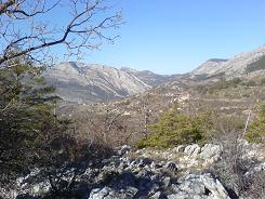
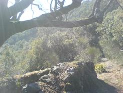
The path is very good and well marked and it is a wide forest road until you reach sign post 87, this is where you take a left and drop down through the trees to the ruins of Rouyere. In fact you can stay on the forest track as it loops round to meet the path later on. The ruins host sign post 87, here you could take a left and make your way back up to La Colette via the GR510. In fact this part of the GR510 is very attractive and I would suggest walking that route - on another day J. This time we turn right and we contour around the mountain, the path is well marked but does not always follow the same route as shown on the IGN Map 3543 ET 1:25000. There are a few switch backs not shown on the map but on the ground the route is well marked with the local path yellow markers.
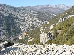
The scenery becomes more spectacular as the walk progresses, as you go around "La Cava" you get your first sighting of limestone cliffs. The cliffs over look the river Siagnole d'Escragnolles and you can hear the roar of the water from your vantage point. Here you traverse the slope going above the cliffs and across scree runs.
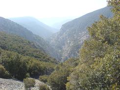
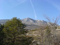
e had lunch on the first cliff top; the limestone is packed with Ammonites. You finally descend to the river and a forest road turn left and this you follow back past Les Gras, the road becomes tarmac before then. The road is very quite but you pass more houses along the way and the route is well sign posted. You join the GR510 at sign post 95 take a right towards Escragnolles, at St Pons turn up to Escragnolles and to La Colette.
Flat distance 12502.35 m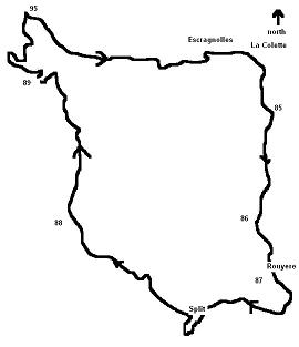
Total height ascended 773 m
Actual distance 12669.24 m
Maximum height 1082 m
Trail : Waypoints
85 East: 32:322394.00 North: 32:4843575.59 Height: 1081 m
86 East: 32:322152.49 North: 32:4842393.79 Height: 993 m
87 East: 32:322258.21 North: 32:4841949.59 Height: 883 m
split East: 32:321355.73 North: 32:4841425.69 Height: 958 m
88 East: 32:320287.20 North: 32:4842399.21 Height: 745 m
89 East: 32:319941.32 North: 32:4844131.74 Height: 825 m
95 East: 32:319867.92 North: 32:4844840.55 Height: 901 m
94 East: 32:321266.73 North: 32:4844127.13 Height: 954 m
Co-ordinates system : UTM (Zones 30,31,32), WGS84
