Boucle de Pelens - St Martin Entraunes - walk - hike
This walk starts from St Martin d'Entraunes in the Haut Var. This walk also features in the Randoxygène Haut Pays. We start from the small car park on the right after the church going north through the village. Directly opposite is the Maire (Town Hall) with one of those “you are here maps”. There is a road going up the hill almost at 90 deg to the main road but the one we want is the smaller one going up the side of the Maire. The path runs parallel to the road below and you pass some houses to a hamlet called le Clouvert.
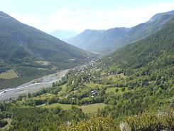
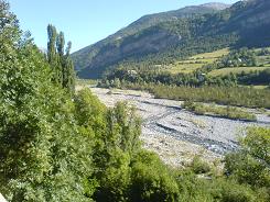
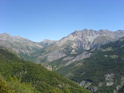
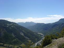
Change direction into the hill to le Villard, here you take a left to take you behind a water treatment installation. Remember it is a local path so you are following the usual yellow markers. After le Villard you start to climb steadily moving northwards all the way and are rewarded by spectacular views of the valley below. There has been some land slides since our map was printed and the marked path is now a little lower than it was on the hill slope. Keep to the path and the yellow markers. Eventually the gradient becomes less and you are almost contouring and come to sign post 239. At 239 the path splits with the right hand fork going back down into the valley, the left hand is the one we take which continues to climb on a wide forest track and changes to a westerly direction.
As you climb the path becomes more forested eventually taking a southerly direction zig zagging through the trees. Eventually you emerge through the trees at signpost 238 and Val Pelens. From here on in you contour or descend. The path takes you through the trees and is macadam until signpost 237. Here the macadam route takes you to the viewpoint and telephone masts or straight on to Chapelle St Barnabé. The detour is worth the hike as the views are amazing. The community have also placed randomly throughout the area information posts relating to flora and fauna. They appear a little “Monty Pythonesque” as they do not really fit in with the surroundings but they are very informative.
There is a tree lined avenue that takes you down to Chapelle St Barnabé and a narrower path along an edge from there to the road.
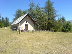
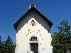
The path takes you across the same road 2 more times then you come to Chapelle St Jean. At the Chapelle the sign post is 235 and there on in the path descends through the trees crossing the road a further 5 times, take care to check up and down the road for the continuation of the path. At the last road crossing you enter the village from the southern side, via a track. There are still farm buildings and buildings with the typical open roofs. The roof eaves were traditionally left open to stock winter feed for the animals. On inquiring at the tourist office in Guillaumes about these open roofs we were told about another architectural oddity of the area. In certain houses they build voids into the exterior walls. These voids can be accessed from the inside as well as the outside and were used for keeping bees.
Flat distance 8999.75m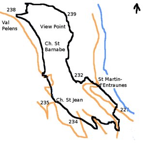
Total height ascended 721 m
Actual distance 9187.46 m
Minimum height 1020 m
Maximum height 1638 m
231 East:32:320915.68 North:32:4890169.15 Height:1041 m
232 East:32:320332.39 North:32:4890451.40 Height:1138 m
259 East:32:320235.59 North:32:4891779.44 Height:1365 m
238 East:32:319297.13 North:32:4891874.96 Height:1598 m
237 East:32:319603.05 North:32:4891578.31 Height:1630 m
236 East:32:319717.13 North:32:4890706.61 Height:1521 m
235 East:32:319867.27 North:32:4890167.77 Height:1447 m
234 East:32:320297.73 North:32:4889783.73 Height:1355 m
233 East:32:320580.80 North:32:4889717.59 Height:1265 m
229 East:32:320578.01 North:32:4889785.73 Height:1239 m
228 East:32:321026.76 North:32:4889468.06 Height:1125 m
227 East:32:321068.72 North:32:4889918.67 Height:1020 m
