Courmes, Bramafan walk
After 3 days of rain the sunshine on Sunday was a welcome and we set off for Courmes to complete more of the GR51. This leg takes us from Courmes to a point near Bramafan and back. I have not seen this walk in any guides but it follows the GR51 and some local paths. It stays below a 1000m which suited us as there was snow on the Pic de Courmettes and the Puy de Tourrettes this weekend. I would rate this as a medium difficulty walk as the paths are good and the climbs are not severe.
Courmes is a village nestled in the Gorges de Loup up a dead end road, the D503. The walk follows the GR51 from the village in the direction of the Pic de Courmettes. The walk takes you through wood land on ancient paths, with stone walls and the outlines of old buildings and makes you wonder the size of community there centuries ago. Follow the red and white GR markers, the first major junction is where the path comes to a divide and a local path takes you directly to the plateau of St Barnabe (short cut on the GPS co-ordinates). Keep right follow the forest road for 10 to15 meters then branch off right following the GR51. This will take through the trees to a large clearing with a forest road (water tank GPS co-ordinates). So far this is the same route as the published for the Pic de Courmettes but we stay on the GR51, by turning left leaving the previously published path. This takes you back under the trees and within a couple of meters on the right there is a milestone, well in this part of the world probably best described as a kilometre stone. On it is marked 19km - no indication of where to or where from but there it sits, as the crow flies Grasse, Nice, Cannes and Vence all fall within that distance but that is not the measure and we are not even sure it is relevant to the GR51.
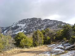
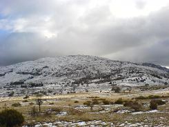
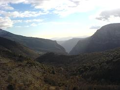
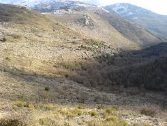
What is for sure is the path follows an ancient thoroughfare, a constructed road that contours below the 2 peaks of the Pic de Courmettes and the Puy de Tourettes. You pass some old buildings in the trees and a roofed building up on the slopes and have some fantastic views of the valley below. Shortly before the plateau of St Barnabé you meet the short cut to Courmes, sign post 84 (GPS co-ordinates). The path then climbs gently to the plateau of St Barnabé, the path from the Puy meets you here sign post 85 (GPS co-ordinates). Keep straight on for ½ a km to sign post 86 where there is an "Oratoire" dedicated to St John the Baptist here you take a 90 degree left turn. This is where it can go a little "Pear shaped", as there is a track and the path follows it for about ½ a km then branches off to the left. The only marker is a little pile of stones with the local yellow splash of paint, or you can do as we did & sail on aimlessly by and realise your mistake later.
The way to check your course is by the electricity pylons - the path does not cross them at this stage, it runs parallel for a bit but that is all. The other check is that you should be descending/contouring and not be on the hill top edge. The next marker - or would be marker is sign post 87a but when we were there is was burnt (GPS co-ordinates) it at a spot where the path forks - the lower fork goes down into an interesting valley, the other we want keeps contouring. The valley below has some interesting limestone formations and caves (we did not inspect closely just viewed from the opposite side). From there you enter a higher valley and cross the valley floor at sign post 87 and head for a shepherd's croft which you pass on the left hand side. Here the land is broken boulder and you head north, there is a wide track and the path runs parallel to it.
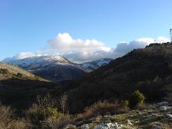
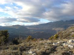
At sign post 154 there is a view of a large farmstead with its own chapel which seems deserted and the path veers north-west for 50 m or so. Then there is a 90 degree turn to the left and this is where you start the descent to Bramafan. There is a great view of Cipières and the path zig zags down the hill through oak woods to the road. Turn left at the road and follow it for 20m. Then take the GR51 again but the direction to Courmes, you are now above Bramafan. The river below was very noisy especially after the rains and was spectacular in flood. From there you climb away from the road through the trees and eventually start to plateau. This finally meets up with the D503 and a yomp to the village approximately 1.5 km.
Flat distance 13057.08 m 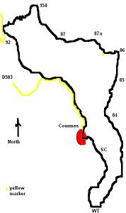
Total height ascended 769 m
Actual distance 13208.10 m
Minimum height 533 m
Maximum height 962 m
Trail : Waypoints
Short Cut East: 32:339971.06 North: 32:4844899.17 Height: 713 m
Water tank turn East: 32:339682.82 North: 32:4843799.07 Height: 872 m
Sign Post 84 East: 32:340181.96 North: 32:4845645.14 Height: 878 m
Sign Post 85 East: 32:340412.16 North: 32:4846368.29 Height: 938 m
Sign Post 86 East: 32:340536.54 North: 32:4846904.09 Height: 955 m
yellow marker East: 32:340256.12 North: 32:4846911.65 Height: 961 m
Sign Post 87a East: 32:339899.25 North: 32:4847209.84 Height: 887 m
Sign in 87 East: 32:339343.68 North: 32:4847288.15 Heigh: 856 m
Sign Post 154 East: 32:338902.26 North: 32:4848033.57 Height: 873 m
Road East: 32:338278.90 North: 32:4847491.78 Height: 534 m
Co-ordinates system : UTM (Zones 30,31,32), WGS84
