Puget-Rostang - Circuit de Mairola - walk - hike
Puget-Rostang is a village north of and above Puget-Théniers. To get there from the coast take the RN 202 to Puget-Théniers at the lights opposite the bridge take a right and follow the signs. The village itself is really attractive perched on the valley side above the Torrent de Mairola. There is parking at the foot of the village opposite an Auberge.
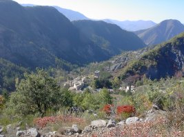
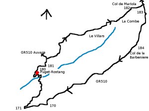
The walk starts from here and follows the road to Auvare. The walk is appoximately 10km with a 1000m climb. It is in the Rando Moyen Pays and classed as "sportif" we class it as a grade 2. The walk circumnavigates the valley behind Puget-Rostang making to the head of the valley and returning on the southern ridge. The initial part of the walk is a GR so look for the red and white flashes. Follow the road to the right - behind the village, it opens out into a yard. Sign post 180 is the left of the building on the left. The path climbs up past the building and comes to a dirt road. Look across the road to the right the path continues there.
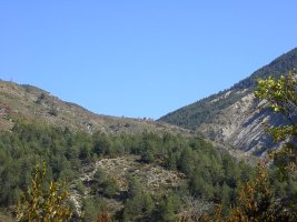
The path bisects this dirt road a number of times as it winds itself up the hill. At sign post 181 the GR510 goes up to Auvare, we are taking a local path to the Col de Mairola. On the local path the markers are yellow. This takes you up the valley side past a number of deserted properties and areas which have been cultivated in the past. The first concentration of properties is called Le Villars the second La Combe, each with their own plateau for cultivation.
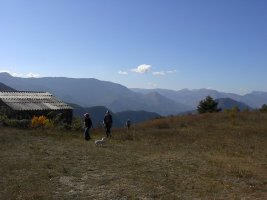
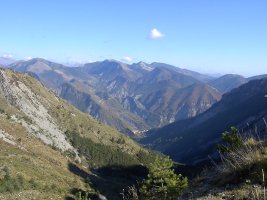
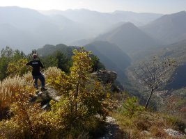
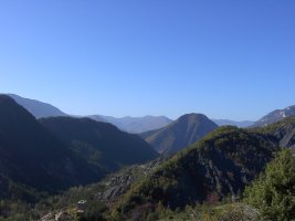
The path takes you on to the pass at the head of the valley, the Col Mariola. The views are fantastic. From the Col de Mairola you can see Rigaud in the valley bellow. From here we start our way back but we need to finish climbing yet. Follow the GR to the Col de Barbenière (take a right). There actually two routes you can take the path itself or the forest road which winds itself up the hill side (less steep).
They both arrive at Col de Barbenière sign post 184. From here you continue straight on and follow the GR510 along the crête or ridge of the valley. The views from here are spectacular of the Var valley as well as the valley of the Mairola. From sign post 170 the GR 510 widens out and then becomes at 171 a forest road. This snakes back down to the village.
Actual distance 9878.05 m
Minimum height 707 m
Maximum height 1483 m
Total height ascended 920 m
SP180 East:32:333131.01 North:32:4871194.40 Height :746 m
SP181 East:32:333374.16 North:32:4871406.10 Height :881 m
SP182 East:32:335458.12 North:32:4872503.69 Height :1240 m
SP183 East:32:335790.53 North:32:4872435.28 Height :1308 m
SP184 East:32:335571.77 North:32:4871679.59 Height :1470 m
SP170 East:32:333332.62 North:32:4870355.38 Height :1054 m
SP171 East:32:332706.55 North:32:4870321.60 Height :943 m

