Col de Vence Plan des Noves walk
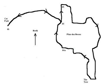
The Plan des Noves is a favourite walk of ours and used as a stop gap when faced with poor weather or short on time, so it was ideal this weekend when we had rain first thing in the morning. One of the advantages of rain here in the Riviera is the effect on the sky, the clarity of the sky the day after the rain is wonderful and it looses the haze that can build up of long periods of sunshine. The distance is about 7km and would be rated easy because of the height gained and ease of terrain. The walk starts at the car park at the Col de Vence about 3/4 up to the Col de Vence on the D2 from Vence. It starts on part of the GR51 (red & white markers) it takes an NEE direction from the back of the car park and you descend down a valley on the Plan des Noves. Keep to the path, there are wider tracks going to buildings on the plain but to avoid a cross country yomp later keep to the narrower path until you get to sign post 64. At that sign post turn left in the direction of Gorges de Cagnes (a wider path) for 5 mins to sign post 64a, then turn right following the direction Plan des Noves.
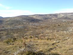
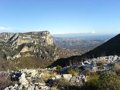
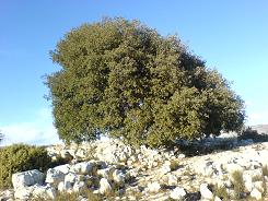
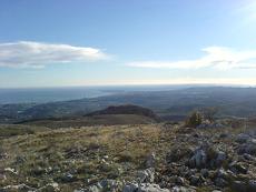
The path leaves the GR51 at this point so now you are following yellow markers, which I am happy to say seem to have recently been re -done. The path crosses the plain to the South East and snakes up the eastern side where you get some great views of the Baou de St Jannet. Then you make your way up to a small ruin, from here on in the path is well marked with yellow markers but does not appear on the IGN maps. The path takes you up the side of hill with an steady incline to a saddle where you cross a path on the IGN map from Magnia-Pau to Blaquières, take that path on the right up the rise and you will come to a evergreen oak (in actual fact 2, well it has 2 trunks  ) and this is a favourite lunch spot, the views are great.
From here on in the path is very straight forward you head north following the markers to the Managi-Pau sign post 64a and then follow the track to number 65 and take the GR51 back to the car park. As a foot note the Tree used as a lunch spot is visible from the coast, to find it look for the Baou de St Jannet then move your gaze to the left, there is a large hill above the Baou des Noirs et Blancs and crowning it is the tree.
Carte 3642 ET IGN
GPS DATUM UTM-WGS84
Flat distance 7886.64 m
Total height ascended 310 m
Actual distance 7926.07 m
Total height descended 311 m
Minimum height 657 m
Maximum height 797 m
66 East: 32:345994.74 North: 32:4846844.79 Height: 788 m
65a East: 32:347181.15 North: 32:4846859.22 Height: 672 m
65b East: 32:347232.86 North: 32:4847239.35 Height: 668 m
Tree East: 32:347753.86 North: 32:4845545.21 Height: 794 m
64 East: 32:347191.89 North: 32:4846275.01 Height: 697 m
