Circuit Marbière - Magagnosc - walk - hike
Again we were blessed with the weather on Sunday and after a late start set off for Grasse up the Route de Napoleon. The start of the walk is just off the N85, just after the roundabout with the D111. There is a tennis court on the right and further up on the left a snack cabin with a carpark. The entrance to the car park is just after the snack cabin, park here. The walk is a combination of 2 walks listed in the Rando Pays Côtier (Tour de la Marbrière and Circuit de Magagnosc), it is 15 km in length, with easily navigable paths so a Grade 2.
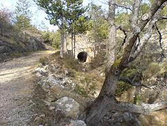
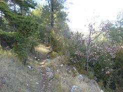
The walk starts in earnest just before the tennis courts and there is a sign marking the way we are heading along the GR4 to the Col de Clapier. The GR4 ends up on the Atlantic coast but we aren't going that far - this time!. From here on in it is a gradual climb approximately 500m in 5km, and 4 waypoints to check. The first is simple enough the GR4 breaks out onto a forest track, keep right there is a wooden sign and the GR red and white signs are evident. The second is where the path starts to level and the first Rando Pay Côtier leaves us "Tour de la Marbrière", it branches off to the right back to the car park. We keep on and we come to a road (3rd waypoint) take a right, every 10 m there is a "do not trespass sign" and it is a bit of a yomp, (I am not keen on road sections). The road section is just over a km long and we come to a "gothcha" (4th waypoint) as the road comes to a severe right hand bend, the path breaks off to the left - we have been caught twice by this little quirk - so be warned!. There is no wooden sign post but there are some confused GR markers on a telegraph pole on the opposite side of the road, and there is a marker and a cairn but easily missed.
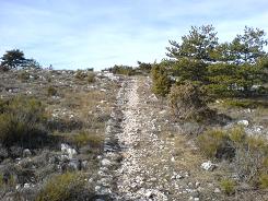
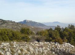
You are then on a delightful stone pathway, a highway from yester yore. From here you have views of Chateau de la Malle a rather austere looking building at the far end of the valley. There are also views of the escarpment bordering the Plateau de Caussols and the RADAR station. Finally you come to a road, the GR4 takes a left here we go right. You follow the road for approximately 800 m and then the path leaves the road on the left hand side. The path is not a GR but it is wide and easy to follow but we are approaching the 2nd "gotcha" of the walk. The path doubles up as a farm track and it is easy to miss the turn off about 1.5km down it, the turn off is on the left before a natural depression and pylon (see waypoints). The path there on in is very wide but broken, it has the border stones of the roman roads mention in previous walks but the stones in the centre are loose. The path now descends for a further 2.5 km down to the GR51. There is a karting circuit not far from this junction and you can hear it 2-3 km away. At the junction take a right and now you are on the GR51, here the path is very wide and skirts the edge of the hills all the way back to the car park (approx 5 km).
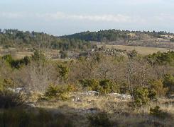
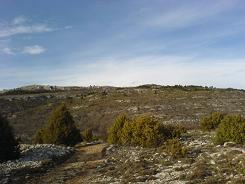
As a foot note we have done this walk a number of times, this was the first time in the hunting season. The GR51 is a main artery for walkers and this section 2-3 km from Grasse and is used a lot by young families going out for walks. In fact we passed two and this was at 5pm on a January evening, with the light fading rapidly. So I was surprised to see a hunter had set up a hide on the edge of the foot path. He was taking a break from his reclined position having a smoke, with his shot gun unbroken under his arm. I have no real feelings about hunting but understand it is a part of the fabric of life here. What I am not sure about is the wisdom to do within range of urbanised areas, initially for the chances of success of bagging any game but also for the safety of others that use the countryside. As a point of safety I do have a brightly coloured pack and it has a small bell, call me paranoid - but as long as wild boar do not support the same accessories I am hoping it will raise my chances of survival.
Flat distance 14915.91 m
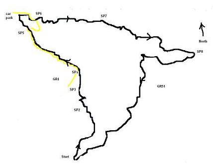
Total height ascended 727 m
Actual distance 15025.64 m
Trail : Waypoints
start East: 32:332391.92 North: 32:4837031.03 Height: 555 m
SP2 East: 32:332576.63 North: 32:4838685.95 Height: 878 m
SP3 Marbriere East: 32:332664.52 North: 32:4839182.37 Height: 921 m
SP4 Gotcha 1 East: 32:331686.08 North: 32:4839927.00 Height: 1010 m
Car Park East: 32:331366.97 North: 32:4840550.24 Height: 1066 m
SP6 East: 32:331738.86 North: 32:4840399.84 Height: 1045 m
SP7 Gotcha 2 East: 32:333344.98 North: 32:4840186.05 Height: 940 m
SP8 East: 32:335377.67 North: 32:4839286.98 Height: 613 m
End East: 32:332391.92 North: 32:4837031.03 Height: 555 m
Co-ordinates system : UTM (Zones 30,31,32), WGS84
