Seranon Crêtes de Bauroux - walk - hike
This is a very pretty and popular walk, it is also featured in the Rando Oxygen. The walk is a grade 1 climbing to 790m covering a distance of 12.75km on well laid out paths. Séranon is on the RN85 after Escragnol on the way to Castellane from Grasse. The walk starts in the village at a small car park next to a cemetery. At this point it is a part of the GR.510 and heads west to the site of the old village nestled just below a pass in the ridge. Why the village moved from the old site to he new? to date I have not been able to find out.
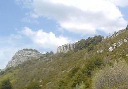
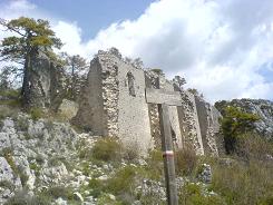
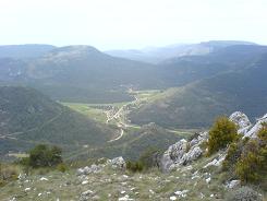
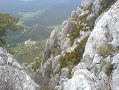
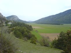
What is obvious is that in times of old the village was prosperous supporting a large community and church. When you look down into the valley, part of the answer may be in the fertile valley floors and cultivated land. The walk has the distinguishing GR markers (red and white) and there is a fork in the path before you reach the village – take the lower path (left). This continues on an easy gradient along the base of the escarpment until you reach a chapel (SP 214). This is another marker on the GR.510 we take the direction Crêtes de Bauroux to the Ruines of the old village.
Follow the path through the village and through the cutting in the ridge- at SP 193 we leave the 510 and take a local path around the back of the Bauroux. This is a north facing slope and can be nice and cool under the trees in summer – in winter cold, we did this walk for the last time in May and there where patches of snow still. We found the path has changed since out map was drawn and it takes a wider route along the back of the crête and on the descent. The summit is free of trees and is marked with a cross and every time we have been her is has never been free of people. The advantage of this traffic is that the walk is well marked and used so very easy to follow. At SP 182 you meet the road look left here as the path takes a dog leg and continues at SP181 up the road. This then drops you onto the valley floor and on your way to Caille. Walk through the centre of Caille taking a right out of it and follow the main road for approximately .75 of a km then you will see a SP 197 on the other side of the road which takes you directly back to Seranon behind the village. Continue on this path and you come up behind the cemetery where the car is parked.
Flat distance 12121.60 m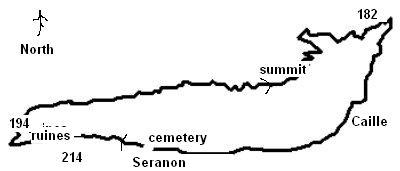
Total height ascended 792 m
Actual distance 12299.61 m
Trail : Waypoints
1 : SP 214 East. : 32:313482.52 North. : 32:4849655.02 Height : 1204 m
2 : SP 194 East. : 32:313299.70 North. : 32:4849851.39 Height : 1285 m
3 : SP 182 East. : 32:317613.42 North. : 32:4850727.29 Height : 1202 m
4 : SP 197 East. : 32:316897.53 North. : 32:4849419.73 Height : 1173 m
