Walks on the Baou de St Jeannet
'Twas the 3rd day after Christmas and after a very wet attempt up the Baou the previous Sunday a glorious walk up to Jas Jausserand was had by one and all. The Baou de St Jeannet dominates the view up the Var from Nice and is a reassuring landmark for frequent air travellers as they land in Nice. There are a number of walks up and around the Baou and it is an excellent climbing area with the limestone cliffs. The quickest route takes you up to the orientation platform and back again in an hour or so, and there is another which takes you around the back of the Baou and down to Castelet - a 7km round trip. The one we will concentrate on today goes up to a delightful valley called the Le Clos de l'Eveque, then on to Jas Jausserand, les Gardioles, Castelet and back to St Jeannet.
Parking in St Jeannet is an issue although now there is a new car park up the main street on the right. Walk up into the center and take the first right. It is sign posted for the Baou - you take a couple of turns and climb out of the village. The path winds up past the last few houses breaking out of the trees and comes to a fork, take the left one past the barrier. The path is wide and well trodden following the side of the valley climbing as you go. There is one switch back and then you come to sign post number 3 for Jas Jausserand - it is straight on so nothing too difficult. The path continues climbing along the valley and reaches Le Clos de l'Eveque a small plateau which hits you as a complete surprise.
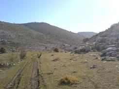
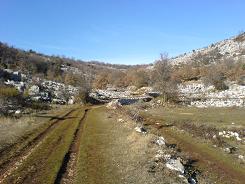
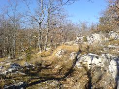
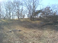
From there it is 5 mins to Jas Jausserand, beware there is the farm track and the foot path which is on the right and goes up past the farm house on the right hand side. At sign post 13 go towards Bezaudun, from behind the farm house you walk up into some beautiful oak forest and sign post number 14 which has been broken by some idiot. (It amazes me how people with brains the size of peanuts can actually walk that far in the first place but I suppose you get idiots every where.) You will want to keep left at 14 - don't go towards Bezaudun. The ground levels out and you in an oak glade that turns to shrub - keep an eye out for the yellow markers here it is the worst area for markers. Approximately 100m after the stone igloo the path splits left - keep an eye out.
The views west and north west from here are great, looking over the Plan des Noves and the Col de Vence
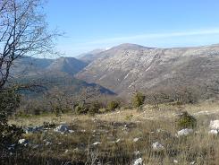
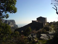
The path then drops down into the trees and gradually turns to the left leveling out but still in the trees. Eventually you get to sign post number 15 where you meet the GR 51 and the markers turn to red and white. At 15 you turn left - peanut brain has been there too and the sign is broken. The path is wider and well trodden, winding through the trees for approx 1.5 km until you get to Castelet. Castelet is a good place for lunch as you have a southerly aspect. The building was supposedly a Templer stronghold, and after the persecution of the Templers, the locals took the building apart looking for treasure. The job was finished by the Germans in the 2nd World War who thought local resistance fighters were holed up there. (The last couple of lines were regurgitated faithfully from a monologue from a guy we met on the walk, sounds good but could be a load of cod.)
From Castelet the path zig zags down and crosses over to the base of the Baou. You pass all the climbing points and then start to ascend into the village - distance approximately 2.5 km. The path turns to asphalt just before sign post 8 and you are in amongst the houses already, The Chapelle of Notre Dame is on your right, and you are on your way back to the car park.
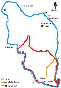
Flat distance 12269.79 m
Total height ascended 767 m
Actual distance 12437.13 m
Total height descended 768 m
Minimum height 380 m
Height difference 0 m
Maximum height 867 m
Trail : Waypoints
SJCP East: 32:350634.24 North: 32:4845750.87 Height: 420 m
SJ3 East: 32:350525.18 North: 32:4846644.91 Height: 639 m
SJ9 East: 32:350517.84 North: 32:4846794.67 Height: 645 m
SJ12 East: 32:350684.13 North: 32:4847949.02 Height: 746 m
SJ13 East: 32:350350.34 North: 32:4848415.47 Height: 788 m
SJ14 East: 32:350178.90 North: 32:4848683.37 Height: 832 m
SJ15 East: 32:348415.32 North: 32:4849114.46 Height: 704 m
SJ7 East: 32:348918.14 North: 32:4847282.61 Height: 721 m
SJ8 East: 32:349945.09 North: 32:4845654.48 Height: 427 m
Co-ordinates system : UTM (Zones 30,31,32), WGS84
Details for the shorter walk 7km
Flat distance 7905.24 m
Total height ascended 630 m
Actual distance 8059.41 m
Minimum height 375 m
Maximum height 786 m
Trail : Waypoints
CP East: 32:350608.15 North: 32:4845829.06 Height: 441 m
3 East: 32:350513.04 North: 32:4846640.40 Height: 643 m
4 East: 32:350457.79 North: 32:4846740.48 Height: 661 m
6 East: 32:350049.14 North: 32:4847037.19 Height: 773 m
7 East: 32:348931.50 North: 32:4847273.97 Height: 720 m
8 East: 32:349860.97 North: 32:4845692.78 Height: 419 m
CP East: 32:350608.15 North: 32:4845829.06 Height: 441 m
Co-ordinates system : UTM (Zones 30,31,32), WGS84
