Courmes - Pic de Courmettes - Puy de Tourrettes - walk - hike
Well, this to me is a walk with a lot of challenges. When you drive up to Courmes from Gourdon, the Pic de Courmettes dominates the horizon. So if you're feeling a little feeble, the Auberge just after the car park in Courmes, may be as far as you want to go. The route takes you up the GR51, splits off to the right and then is a scramble up to the Pic de Courmettes. From the Pic de Courmettes, take the shoulder to Puy de Tourrettes, climb to the summit and then drop down to the plateau of St Barnabé. Then it is back onto the GR51 to Courmes. The walk summary is below and shows the full walk -12 km, there is a short cut, where you can cut off a loop in the GR51 - this brings the overall distance down to 10 km.
So why a lot of challenges? - the scramble up the Pic is steep; the climb to the Puy always seems longer than it is, the views from both summits are wonderful, hard to take in, and the sense of achievement looking back over the route makes it difficult to put the walk into perspective.
We were very lucky. There had been rain for 3 days but on the Sunday it was bright and clear. The drive to Courmes is a little involved as it is up the Gorges du Loup and the roads have to succumb to the geography.
Whichever route you take, the scenery is spectacular and you end up the D503 which is a narrow road with passing places leading you to Courmes. In Courmes there is a car park on the left on the way into the village, which leads onto a green. Use the car park and walk up the road that leads off to the left before the entrance to the village itself. The road swings round and the first sign post for the GR51 is visible at the top. The path is marked the GR51 (red and white markers). Take the direction Pic de Courmettes, St. Barnabe. The path is well established and has stone steps.
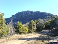
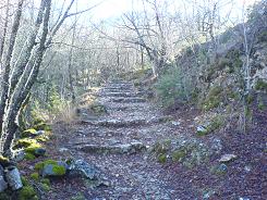
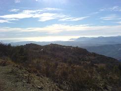
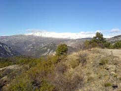
The path is sometimes bordered by a wall and there is evidence of a much larger and ancient settlement, as there are outlines of buildings and enclosures. We have walked this in the spring and then there is a luxurious canopy of leaves from the mainly deciduous trees. The path is bisected by tracks but keep straight on, if unsure look out for the red and white markers - they will indicate the correct route. Where the short cut to St Barnabe meets the GR51 there is a sign that has been vandalised. Just keep right on the forest road for about 100 m and the GR51 splits off again on the right. This leads you through more woods and the path is back on an ancient track until it emerges again onto a forest road. At this point we leave the GR51, take a right up the forest road and keep to it. There is a water storage tank on the right and the forest road climbs and banks to the right. Keep going and the road opens out onto a small plateau at this point take in the view - it will be hard not to.
On the left hand side of the road there is another sign post which has been vandalised - it indicates the route around the Pic de Courmettes and also marks the point where we go up it. Remember we are off the GR and on a local path so the markers are yellow, take care to follow these up the Pic.
The path up the Pic is a scramble in places and you have to keep an eye out for the markers. There are also some little cairns (piles of stones) that help to mark out the route and remember to zig zag where possible as it reduces the steepness of ascent (the path does). The path follows to the left of the rocks on the whole and brings you out at the foot of a boulder face which in the spring is covered in flowering Thyme - the perfume is intoxicating. The path is still marked here and follows the base of the boulders for 10m or so and then starts to zig zag up the face of the boulder field. The path takes you to a false peak and there is a small tree that marks a point where a gully can be crossed to take you to the summit. At the summit there is a small enclosure and a good place to take lunch the views from here are breath taking, especially after a period of rain as the sky is clear.
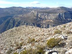
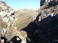
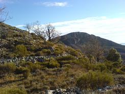
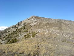
From there on in you drop to the saddle between the two summits and the path tries to hug the edge but makes small diversions to avoid thickets and rock outcrops. The path is clearly visible before you as you climb the Puy de Tourrettes - just take care as you close on the summit to look out to the left and the edge as it makes it easier to cross the top.
At the summit, the Puy de Tourrettes is flat and there are a number of cairns. Keep left and follow the cairns. Ahead there is a depression - keep left of that and the path will appear before you. From there you start your descent onto the plateau of St Barnabé past a very impressive ruin where the path flattens out. At this point we pick up the GR51 again take a left towards Courmes. Either keep on this until you come to the water tank mentioned on the ascent, or take the short cut that takes you via sweeping turns directly to the village - (you actually pick up the GR51 approx ½ a km outside of the village).
Flat distance 12690.20 m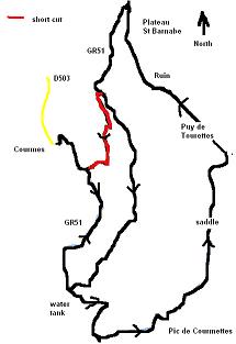
Total height ascended 927 m
Actual distance 12890.99 m
Total height descended 928 m
Minimum height 626 m
Maximum height 1260 m
short cut East: 32:339963.61 North: 32:4844911.77 Height: 712 m
Water Tank East: 32:339693.52 North: 32:4843775.16 Height: 875 m
path to Pic East: 32:339936.49 North: 32:4843320.00 Height: 933 m
Pic de Courmettes East: 32:340803.74 North: 32:4843608.03 Height: 1238 m
Puy de Tourrettes East: 32:341315.02 North: 32:4844965.21 Height: 1257 m
RUIN East: 32:340713.14 North: 32:4845630.71 Height: 1097 m
GR51 East: 32:340478.01 North: 32:4846433.10 Height: 944 m
Short Cut East: 32:340168.36 North: 32:4845647.66 Height: 873 m
Co-ordinates system : UTM (Zones 30,31,32), WGS84
